Plus, what to know about postpartum depression ͏ ͏ ͏ ͏ ͏ ͏ ͏ ͏ ͏ ͏ ͏ ͏ ͏ ͏ ͏ ͏ ͏ ͏ ͏ ͏ ͏ ͏ ͏ ͏ ͏ ͏ ͏ ͏ ͏ ͏ ͏ ͏ ͏ ͏ ͏ ͏ ͏ ͏ ͏ ͏ ͏ ͏ ͏ ͏ ͏ ͏ ͏ ͏ ͏ ͏ ͏ ͏ ͏ ͏ ͏ ͏ ͏ ͏ ͏ ͏ ͏ ͏ ͏ ͏ ͏ ͏ ͏ ͏ ͏ ͏ ͏ ͏ ͏ ͏ ͏ ͏ ͏ ͏ ͏ ͏ ͏ ͏ ͏ ͏ ͏ ͏ ͏ ͏ ͏ ͏ ͏ ͏ ͏ ͏ ͏ ͏ ͏ ͏ ͏ ͏ ͏ ͏ ͏ ͏ ͏ ͏ ͏ ͏ ͏ ͏ ͏ ͏ ͏ ͏ ͏ ͏ ͏ ͏ ͏ ͏ ͏ ͏ ͏ ͏ ͏ ͏ ͏ ͏ ͏ ͏ ͏ ͏ ͏ ͏ ͏ ͏ ͏ ͏ ͏ ͏ ͏ ͏ ͏ ͏ ͏ ͏ ͏ ͏ ͏ ͏
July 31, 2026—A glimpse of underwater volcanism, a near-collision of two AI results and the start of a decade-long “movie" of the sky.
—Robin Lloyd, Contributing Editor
|
|
This map shows a representative week of observations by the Vera C. Rubin Observatory for its decade-spanning Legacy Survey of Space and Time. Each color-coded tile represents one of six filters used for an individual exposure. NSF–DOE Vera C. Rubin Observatory/NOIRLab/SLAC/AURA
|
|
Using the new Rubin Observatory, astronomers are capturing the start of a decade-long “movie” of the sky that is expected to be revolutionary. | 5 min read
Pumice, or “frothy rock,” floating in seawater near Papua New Guinea signaled a chance for a rare glimpse into underwater volcanism. | 3 min read
Two research efforts used the same AI model to solve the same “unclonable encryption” problem via different means. Their results were published 3 hours and 18 minutes apart, raising questions about what counts as independent discovery. | 4 min read
Postpartum psychosis is an understudied yet treatable disorder. The condition is gaining attention with the trial of a mother who allegedly murdered her young children during a psychotic episode. | 2 min read
The devastating, atomic bombing of Hiroshima in 1945 created a bizarre new metallic alloy. Scientists just discovered it. | 2 min read
Lakes of liquid methane on Titan, Saturn’s largest moon, could someday offer exhilarating—and terrifying—opportunities for otherworldly surfing. | 5 min read
“Protein maxxing” is all the rage, but a research summary of more than 350 previous studies found widespread evidence that eating less protein could help you live longer. | 5 min read
|
|
Sleep Lost to Heat
Heat waves can cause kidney problems, heatstroke and even death. When temperatures remain high overnight, the extreme heat also takes a toll on our sleep, report Scientific American's Jackie Flynn Mogensen and Sanidhya Sharma. Between 2020 and 2025, high overnight temperatures cost the average person across the world an estimated 56 hours of sleep per year, according to a recent analysis from the nonprofit Climate Central. Climate change accounts for about six hours per year of that loss.
Why this matters: Sleep loss puts us at risk for poor mental health and higher rates of heart disease and obesity. It can even increase the occurrence of intrusive thoughts.
What the experts say: “There are subtle and small ways that climate change is eroding our quality of life. It may not feel like a lot now, but if you look at the trajectory over time, it’s clearly increasing. And if we continue to warm, it's just going to get greater,” says Kristina Dahl, Climate Central’s vice president for science.
|
|
|
|
|
|
BROUGHT TO YOU BY SCIENTIFIC AMERICAN
|
|
Join the SciAm Summer Reading Challenge!
Summer's halfway over! But it's not too late to join our summer reading challenge. Fill in your Scientific American Summer Reading bingo card by exploring everything from eco-horrors to STEMinist romances to movie adaptations. After completing a square on the bingo card, tag us on social media or email contests@sciam.com for a chance to win one of 40 prize packages.
|
|
|
|
|
Every Friday in summer we're recommending a great, freshly-published science read. Tell us what you're reading, fill in your bingo card and happy reading!
|
|
Coding Kids: Big Tech's Battle to Remake Public Schools
By Natasha Singer. Norton, September 8, 2026.
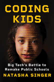 Computer coding has taken the education world by storm, and the rise of artificial intelligence has amplified the craze. Tech industry giants like Google and Apple are pouring money into new coding curriculum—to their own benefit, and at the expense of students’ actual learning, as author and technology reporter Natasha Singer details in her new book. Singer gives a fascinating account of Big Tech’s outsized influence on how programming and AI are taught in schools: coding, once presented as a tool students can use as widely as reading or arithmetic, has been supplanted by a PR campaign for tech corporations disguised as “learning.” This is vital reading for anyone invested in the American education system. —Jennifer Hackett, Copy Editor Computer coding has taken the education world by storm, and the rise of artificial intelligence has amplified the craze. Tech industry giants like Google and Apple are pouring money into new coding curriculum—to their own benefit, and at the expense of students’ actual learning, as author and technology reporter Natasha Singer details in her new book. Singer gives a fascinating account of Big Tech’s outsized influence on how programming and AI are taught in schools: coding, once presented as a tool students can use as widely as reading or arithmetic, has been supplanted by a PR campaign for tech corporations disguised as “learning.” This is vital reading for anyone invested in the American education system. —Jennifer Hackett, Copy Editor
|
|
|
|
|
MOST POPULAR STORIES OF THE WEEK
|
|
How a 99-year-old mathematician unraveled a century-old braid mystery | 4 min read
Hundreds of never-before-seen ancient ‘earthworks’ discovered in the Amazon | 3 min read
Has NASA already found life on Mars? | 12 min read
|
|
Reach out any time to newsletters@sciam.com with your comments or questions. We read every email and respond to many. Hope you have a great weekend!
—Robin Lloyd, Contributing Editor
|
|
|
|
|
Subscribe to this and all of our newsletters here.
|
|
Scientific American
1000 N West Street, Suite 1200
|
|
|
|
|


